
Friday, July 31, 2009


Ape Canyon, Washington
This is where Bigfoot lives.


Mt. St. Helens in the clouds.
The old flow.


Crevis, looking North.

Ape Canyon, the snow melt started a water fall.
 The start of a creek.
Badger Creek Wilderness
Great recovering forrest. The creeks are loaded with trout, we caught several and had them the same night. Rowan almost jumped onto a rattlesnake. Deer walked by our camp, followed by a large black bear. This is a great spot. A four day weekend, and we didn't see anyone else in the forrest. Now we are really backpacking.
 Snake!


 Started with flint and steel and old mans beard.
 Snake!
Our camp on a small saddle. the creek ran around this spur so it was on both sides of us.

Weird ground cover.


 Started with flint and steel and old mans beard.


Sunday, April 19, 2009
First Overnight of the Season

Finally the weather and the weekend lined up for a hike in overnight camping trip. Hikers Camp is in the Clatsop State Forrest, an easy hike up from Indian Head beach. Lewis and Clarke came through here.
The simple plan was to leave after work and get to the campsite before dark. We wanted to stay Friday night, Saturday, and travel back Sunday afternoon. As simple plans become complicated and any amount of work expands to fill the time allotted; we got a late start. We hit a fast food drive through on the way out. Dinner was taken care of.
It was a pretty drive to the coast, and not much traffic. The sunset was good, we saw it from the parking lot next to the day use pay site. We had to buy three days of parking for our two night stay.
I love getting into a campsite in pitch black. We were quite, on the way in we noticed a neighbor had a light on. We picked the driest spot we could find. Set up was ok, we got the tent up and unpacked quietly. After a nightcap of grapefruit infused vodka, we were ready to rest.
Sometime in the night, the loud group came into camp. People really don't understand how sound travels in the quiet wood. Finally it was silent again and we were resting. Sometime later, the lost one of the loud group came into camp yelling for Bret . . . something . . . and shinning a light on our tent. We politely muttered "No", and Bret yelled for the friend to join up with the group. Another hour or so it was quiet, and we slept.

The forrest here has no visible dirt, everything is made up of decomposed plants. The sitka spruce take advantage of this environment and grow out of downed grandparent trees, called nurse logs.
There's a WWII bunker on the trail to the lighthouse lookout. It's something to see while you are in the neighborhood. The lighthouse is now a bird sanctuary.


I guess that's why the trail is here, it's the old service road for this bunker.
The lighthouse is now a bird sanctuary.

Saturday afternoon we met a few other groups brave enough to try an overnight in the coast range. We started a fire in the common fire ring, wood was a five dollar donation. The fire attracted the nice groups. During our fire watch gathering a large group with fo
ur unruly dogs arrived. The dogs were uncontrollable with a lead Boxer that wanted to display dominance on everybody and everything. This group did not come up to join the fire.Sunday morning early we were awakened by the dogs, not so nice. We decided to pack up and leave early. We got breakfast on the deck of a café in Cannon Beach and went home to take a nap.

Monday, March 30, 2009
Coyote Wall
We headed to the Gorge hoping to find some sun and open spaces. Our destination was Coyote Wall, on the Washington side of the Gorge. The weatherman said mostly clouding with a chance of rain, yesterday we drove to the coast through nonstop rain with a generous amount of fog thrown in, so any hint of sun would be welcome. We had some rain and hail on the way but the sun was winning out by the time we got to the trailhead. The trail starts out at the base of Coyote wall and follows old Hwy 14.

They must have gotten tired of removing the rocks from the highway, if you look close you can see the old highway on the right and the new highway on the left.

From the bottom, the wall looks tall and level, but the eye is fooled. The hike to the "top" of the wall was nothing compared to the hike along the top edge of the wall, it was steep.
 We hiked up through meadows where wildflowers were starting to bloom and we had gorgeous views of the the river below us.
  The wind was getting stronger so we had our lunch in the shelter of some large rocks, the sun felt good and we could smell the wild garlic growing nearby. Then the wind really picked up.
 Not quite as bad as Saddle Mountain, but strong enough to take your breath away. And cold despite the sun.

The plan was to follow the wall back toward the hills and then find a trail down the face of the wall. But the wind made it scary to be near the edge so we followed random trails (meaning we got lost) down the back side.

Tuesday, March 24, 2009
Neahkahnie Mountain
March 22, 2009
The weather forecast was better for the coast, so we went there instead of the Gorge. This trail winds through a neat spruce forest. The land and the vegetation change several times, leading to different type of woods around every corner.

We started at the highway 101 parking lot for the old state park campground. It's day use only now so I guess the campground no longer allows overnight camping. Crossing Necarney creek was easy, as somebody put in a suspension bridge.


There were several downed trees, some of them are huge, imagine seeing this one fall: it was about 200 feet tall.


March 22, 2009
The weather forecast was better for the coast, so we went there instead of the Gorge. This trail winds through a neat spruce forest. The land and the vegetation change several times, leading to different type of woods around every corner.

We started at the highway 101 parking lot for the old state park campground. It's day use only now so I guess the campground no longer allows overnight camping. Crossing Necarney creek was easy, as somebody put in a suspension bridge.

There are some impressive trees here. The trail even goes through the middle of one of the smaller trees.


They look like brontosaurus roaming the hillside.

There were several downed trees, some of them are huge, imagine seeing this one fall: it was about 200 feet tall.
Finding the little trail to the summit was tricky, the book said look for two fallen trees and take a left. It seems like every few hundred feet there were two fallen trees; it became a running joke. We finally made it to the top for a sit down lunch, and enjoyment of the views. We stumbled on a reference marker for the Neahkahnie 2 bench mark placed here in 1926 by the US Coast and Geodetic Survey. I keep forgetting to research this stuff before we hike. It turns out there is a cache here somewhere as well.


We thought we were going to be ok with the weather; we left the summit before a big cell came through the area. The hail hit us pretty hard; we stopped under the cover of a tree. The hail starts to hurt on a cold face.

Going back down we stopped and looked at Devils Cauldron.

Nice views and calmness there.

Except for the mud, a very nice day.
Monday, March 9, 2009
March snow! Elk Mtn. to Elk Creek

We got a late start again. This time it was not just us, there was the Daylight Savings time change.
Anyway, We liked Elk Mountain so much we decided to go back. This time we planned to return on Elk Creek trail. It's about 7.5 miles. It took us 7.5 hours.
We knew the fun was about to begin as it was snowing on us on the drive there. Fresh powder.
The hike up Elk Mountain was not as bad as we remembered the hike down last time we were here.
It's only 1.5 miles up, . . . . except you gain 1900 feet in elevation. This is very steep. The whole time it was snow showers and we were the first on the trail, so we had to navigate.

The trail is hidden under the snow sometimes.

Parts of this trail are very steep, requiring quadruped locomotion (hands).
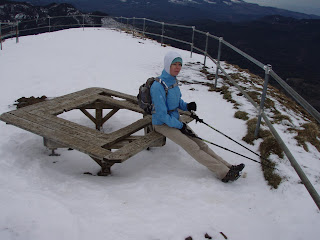
We had lunch at the summit, and took the picture now on the banner of this blog. The log looking thing to the left of the packs is a container containing a written logbook of peoples visits. We had brief sun, about 2 minutes for our lunch stop. We saw a couple who followed our footprints up. They seemed a little out of place, the girl was in sweat pants. Odd it was.
After lunch it was down the cliff toward Kings Mountain. This was exciting, you could not see your footing, and if you missed a step you would go down the fast way. Both of us probably strained something going down. As I am writing this the next day, I am still sore going up and down stairs.

This trip R was able to trick her old Gateway computer into uploading the Topo region onto the GPS. We needed it, the trail was not visible at all in spots.
Only one time we back tracked to a peak to get our bearings and compare to the map. It cost us about 10 minutes, but well worth it to know you are not lost.
The entire trip back toward Elk Creek was in about a foot of new snow and about a foot of old snow. Of course, this was only the last two snowfalls. The depth of real snow was about six feet at times. We were able to walk on top of the crust layer of the snow pack, plowing through the fresh powder. This was slow going. Every now and then we would break through and go hip deep before we got stopped with poles and limbs. We realized we were walking over the winter blow down trees covered in snow. Very slow going.

Finally at Elk Creek, we are going downhill. Maybe we would make it out before dark. The progress was slow again, climbing over trees while you are fatigued takes time.
This one was a work out.
This one was a work out.


Sunday, March 1, 2009
Saddle Mountain Saturday
Saddle Mountain, Oregon, 28Feb09
Another later start than planned. We had on new boots. After Dog Mountain, we went out the next day and got new boots for the snow. D got some HiTek hikers, R got some really expensive (well worth it) Asolo hikers.
The day was overcast and cold. We have done this hike a few times, it is never the same. Today was fresh snow from last night, about 3 inches at the trail head. There were five vehicles in the parking lot and a family making snowmen and starting a fire for warmth. It might be a nice day yet. 

At the bottom we still had dry feet and no blisters. What a great day. The up and back was only about 5 miles, took us about 3 hours.
Another later start than planned. We had on new boots. After Dog Mountain, we went out the next day and got new boots for the snow. D got some HiTek hikers, R got some really expensive (well worth it) Asolo hikers.
The day was overcast and cold. We have done this hike a few times, it is never the same. Today was fresh snow from last night, about 3 inches at the trail head. There were five vehicles in the parking lot and a family making snowmen and starting a fire for warmth. It might be a nice day yet.

The melt is on, this is the trail for a little ways. It's running.
Uphill is all up hill on this one. We met 3 other groups, with several dogs. The snow was not deep, the drifts were about 2-3 feet but compacted enough to walk on.

From the top you can see Mt. St. Helens, Mt. Jefferson, and the Columbia River meeting the ocean. Yes that horizon is the ocean. The views do not get the proper credit from the camera.


We almost ran back down. The wind today was about 60 miles an hour. It changes your balance and steals your breath. It's cold in the wind. We met 3 other groups on the way down, we warned them about the wind.
At the bottom we still had dry feet and no blisters. What a great day. The up and back was only about 5 miles, took us about 3 hours.
Subscribe to:
Posts (Atom)